
Follow a Bucks County Street by Address
The most reliable street directory method in Bucks County starts at the Bucks County Board of Assessment Appeals, not at a deed index. The Bucks County Recorder organizes its records around parties rather than locations. An assessment address search can first connect a physical address to a map or parcel number and an assessed owner. The parcel number then travels with the search through the Bucks County map, a recorded document, Bucks County Tax Claim material, and the municipality that holds local files. This order helps separate a current property record from a claim about a household.
- Search the exact number and road in the Bucks County Assessment iCare system. For a whole road, use the street field and add direction or suffix only when needed.
- Save the map or parcel number, situs address, assessed owner, municipality, and any displayed sales clue. The parcel number is the stable cross-office key.
- Open the map category or the Bucks County Parcel & Floodplain Viewer to confirm the selected polygon and its immediate setting.
- Use the owner name and likely sale period in LANDEX WebStore. Search the acquisition deed and follow its recital, also called a being clause, to the prior document.
- For an early chain or an uncertain result, use the Recorder research area rather than treating a modern online no-hit as a final answer.
That walk is about parcels and recorded parties. It can support property, family-history, estate, civic, or scam-prevention research, but it cannot turn an assessed-owner entry into a verified list of present occupants.
Search Bucks County Street Parcels
The Bucks County assessment help gives the clearest county-supported way to browse a road. In Address Search, a street name can be used without a restrictive house number to return assessed parcels on that street. Wildcards work in the street and number fields. Bucks County results are held only for the browsing session, display 20 at a time, and a map number opens the underlying record. The detail view can include profile, sales, assessment values, land and building details, sketch, map, and, where stored, permits.
| iCare control | Input | Street-directory use | Format note |
|---|---|---|---|
| Address number | Optional text | Narrows to a house number | 11* can broaden a number search. |
| Direction | Optional list | Separates compass-direction streets | Choose a listed direction when needed. |
| Street | Core text field | Finds a road or its assessed parcel set | Sun* can match a fragment. |
| Suffix | Optional list | Distinguishes road types | Use the system list only if it helps narrow results. |
| Parcel number | Text | Returns a selected property record | Partial matching is documented. |
See the official Bucks County iCare search help before starting a broad address query.
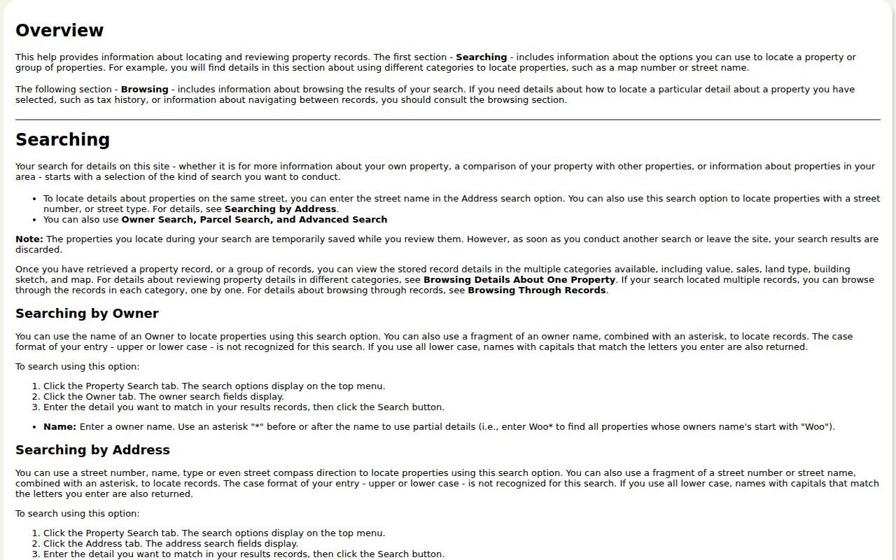
The help screen supports an address-to-parcel workflow, not a street roster of people. Open records one at a time and retain the selected map number.
- Parcel or map number
- The county identifier that joins the assessment record to map, tax, and deed research.
- Situs address
- The physical location of the parcel, which can differ from an owner's correspondence address.
- Plat or plan
- A recorded subdivision or land plan that can clarify lot and block context.
- Criss-cross directory
- A historical address-to-name directory, if a local collection actually holds one for the period.
Map a Bucks County Street Parcel
Bucks County GIS tools add map context after the property search. The Bucks County Planning Commission serves all 54 municipalities, and the Parcel & Floodplain Viewer can show a parcel polygon, roadway setting, nearby parcels, municipal context, and available map layers. Assessment help describes highlighted aerial maps and controls to zoom, select a parcel, select and zoom, recenter, and return to the record. These are useful checks when the same road crosses a municipal boundary or when a postal community name does not match the legal location.
Bucks County GIS is not a survey, a title opinion, or a resident list. Select a parcel on the map, return to its assessment record, and repeat only for the parcel needed. The viewer can be reached through the Bucks County Parcel & Floodplain Viewer item page.
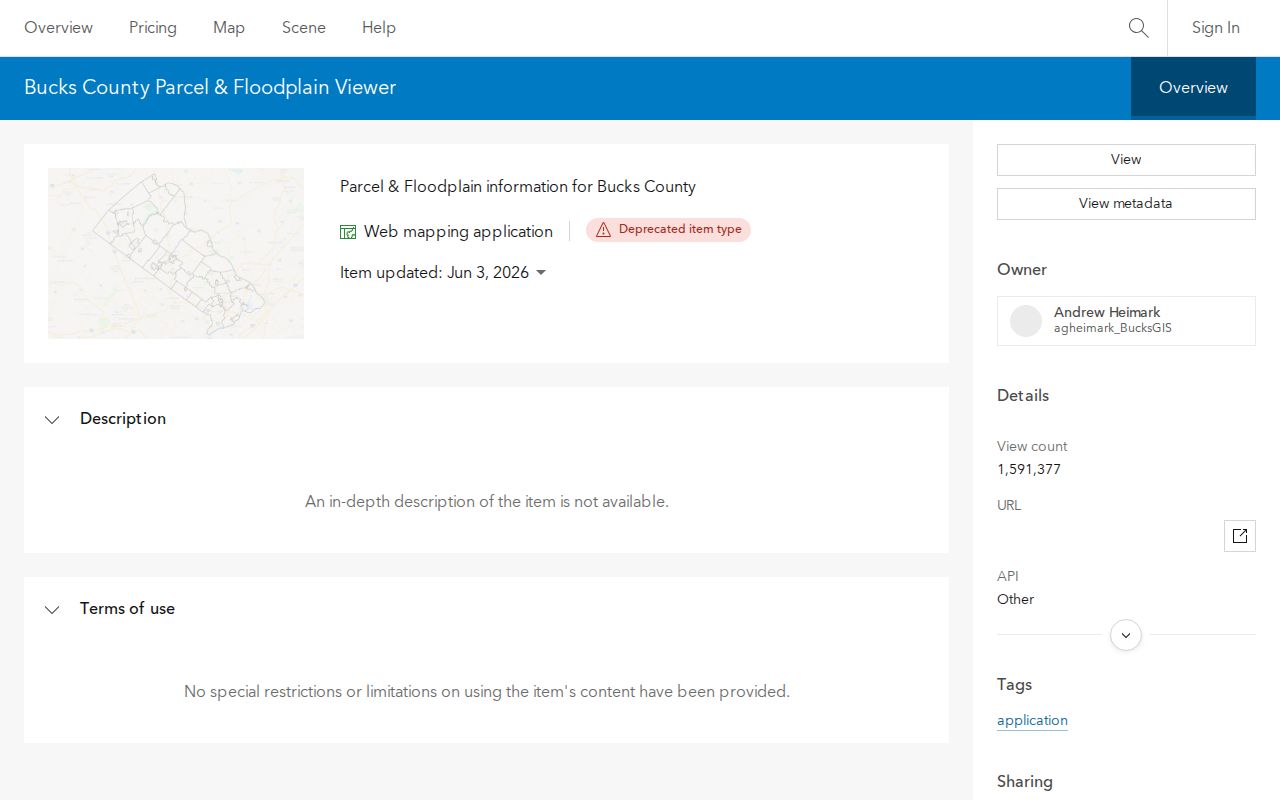
Use the map to confirm which parcel is being discussed before moving to an assessment card or recorded instrument.
Note: A map polygon and an aerial image provide context, but the recorded instrument supplies the legal description and the actual predecessor reference.
Match Bucks County Street Records
Different address-keyed systems answer different parts of a street directory question. Assessment supplies a current assessed record. GIS supplies the parcel setting. The Recorder supplies recorded parties and instruments, but searches there are by party and period. The Bucks County Tax Claim Bureau has a property route, while municipal offices keep many permits and code files. Treat each result as a dated statement from its custodian. A tax correspondence address, for example, is not a declaration that the owner occupies the physical parcel.
| Address record | Custodian | Street-level evidence | Access boundary |
|---|---|---|---|
| Assessment property record | Board of Assessment Appeals | Assessed owner, parcel number, situs, sales and physical-property categories | Free iCare search; data updates on Monday night. |
| Parcel and floodplain map | Planning Commission GIS | Parcel geography, road and municipal setting, nearby lots | Map reference only, not title or survey proof. |
| Recorded deed, mortgage, or plan | Recorder of Deeds | Recorded parties, legal description, recital, plan references | Party and year index; remote LANDEX access is paid. |
| Tax Claim inquiry | Tax Claim Bureau | Claim-related property, owner, location, and mailing fields | Delinquency evidence, not proof of ownership or occupancy. |
| Permit or enforcement file | Applicable municipality | Local address-based work or case material, if public | No unified countywide permit or code search was located. |
The Bucks County parcel number is the key join. Bucks County recording requirements require a County Tax Parcel Number on real-estate documents, so it is more dependable than guessing from a ZIP code or a postal place name. For a full history of a single address, the Bucks County previous residents page follows the backward deed trail rather than rebuilding it street by street.
Bucks County Street Tax Claim Fields
The Tax Claim Public Access form can support a Bucks County street directory trail after a parcel is known. Its property inquiry accepts a complete parcel number with all dashes, location address, school district, municipality, owner last-name-first, mailing address, city, and ZIP. It is useful for comparing the parcel location with an owner's tax-correspondence details or a delinquent-tax proceeding. The form is not an address directory and does not establish that an owner or claimant occupies the site.
Start with the property location or parcel number. The ZIP box appears with Mailing Address and City under owner information, so it is not a ZIP-wide street filter. A Tax Claim result should remain a dated property-status clue. Its statutory sale process and mailing fields cannot settle title, present occupancy, or the outcome of a claim.
Bucks County Tax Claim Public Access provides the form used for this limited property inquiry.
Trace a Bucks County Street Deed
LANDEX becomes useful after assessment has supplied an owner and a likely transaction period. Bucks calls the seller or borrower the Direct Party and the buyer or lender the Indirect Party. In General mode, select BUCKS, use the company or last-name field and the first-name field for an individual, choose a document type, and add dates when a surname is common. The WebStore also has Instrument Number and Book and Page modes. Its name search is limited to 250 matches, so a first-name fragment or date range matters.
Open the acquisition deed and find the legal description and recital or being clause. That language identifies an earlier seller and a prior book, page, or instrument reference. Documents recorded since July 1, 2012 use an instrument number rather than a new book/page. Earlier work may cross the county's historic index groups, beginning with 1684-1919 and continuing through the modern 1999-present group. A no-hit online name search may mean the research method must change, not that the older deed is absent.
The LANDEX document search shows the available general, instrument-number, and book-and-page routes.
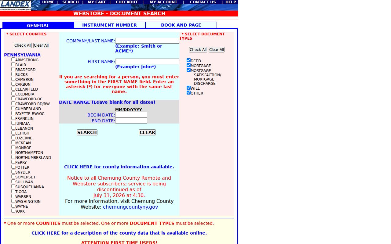
WebStore documents are purchased and delivered as PDFs. Certified copies must come from the courthouse, and the public research area remains the better fallback for a difficult historic index.
Bucks County Street Records at the Recorder
The Bucks County Recorder of Deeds keeps real-estate records from 1684 to the present. It maintains deeds, mortgages, subdivision plans, and other instruments, but recorded military discharges are an exception to the usual public-record rule. The public research area is at 55 E. Court Street, sixth floor, Doylestown. The office is open weekdays from 7:45 a.m. to 4:15 p.m., with recording submissions due by 4 p.m. Staff can offer a short LANDEX tutorial and may arrange specialized assistance, although they do not conduct title or historic research for visitors.
Remote access is not the only channel. LANDEX WebStore charges the document price plus a $5 order-processing charge. The Bucks County Recorder also accepts copy requests by phone or mail, and a property owner can request a complimentary copy of that owner's deed by email. Bucks County guidance lists public-computer copies at $0.50 per page, staff, phone, email, or mail copies at $1 per page, and certification at $1.50. Bring the party name and approximate year when an old street address is not enough.
Use the official Recorder of Deeds office page for the current public-service details.
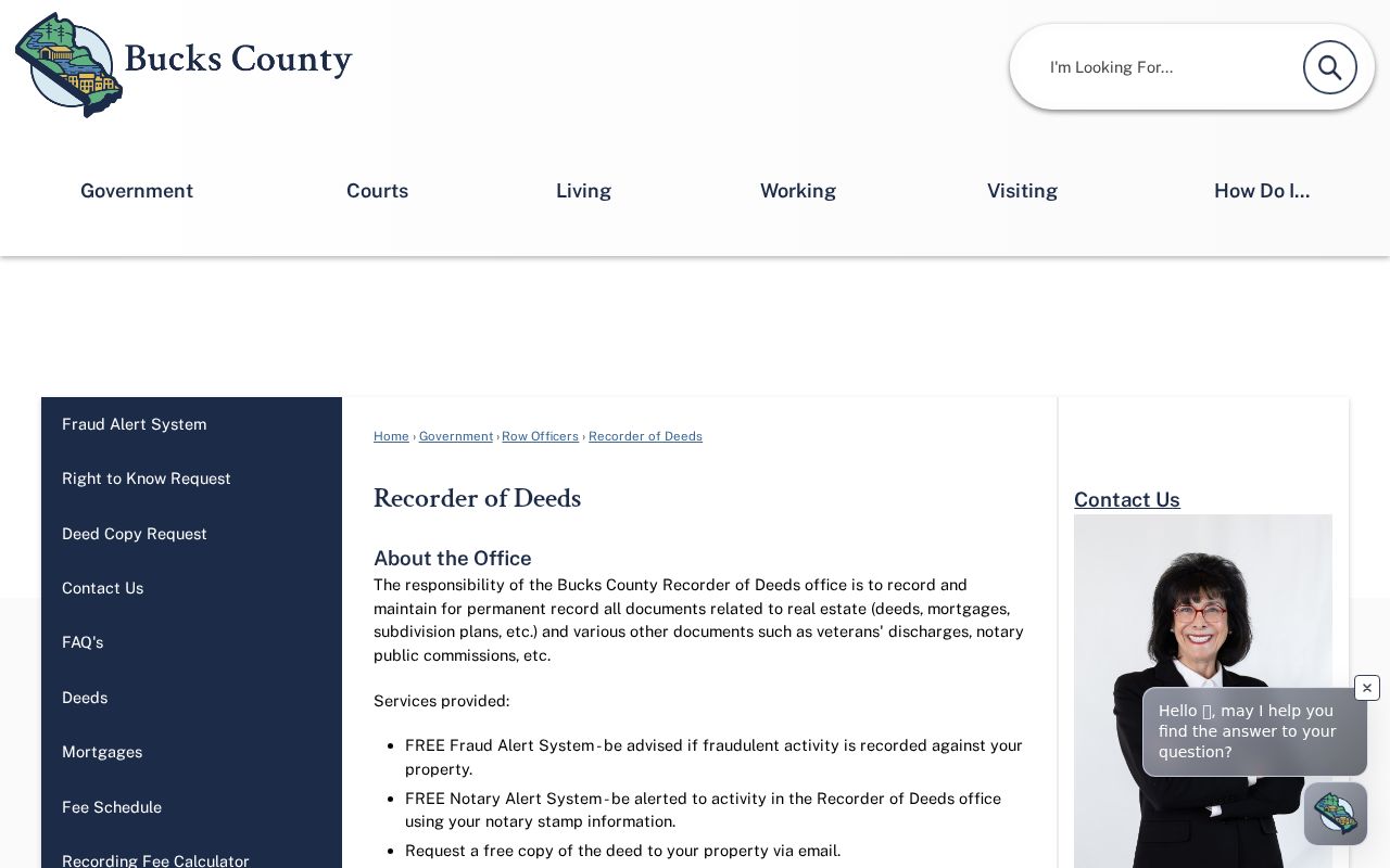
The Recorder is the source for a recorded document or certified copy, while assessment and GIS supply the address and parcel lead that makes the record search practical.
Route Bucks County Street Permits Locally
A Bucks County street directory cannot promise one county permit or code-case file. Bucks County has 54 municipalities, and local governments or their contracted building-code offices retain permits, inspections, occupancy certificates, property-maintenance cases, and enforcement material. First identify the parcel municipality through assessment and GIS. Then use the Bucks County municipal directory to find the office that actually keeps the address record.
That routing step also protects against a common address mistake. A postal town and ZIP code are delivery labels, not legal jurisdiction. A recorded deed may use a tract, lot, subdivision, former road label, or municipal name unlike today's mailing address. Match the parcel number, recorded plan, municipality, adjacent-owner calls, and deed recital before deciding the trail has failed. No official Bucks County source in this research identified one countywide road-renumbering year or a universal retrospective street-name converter.
Bucks County Street Deeds Since 1684
Street research can reach much farther back than a modern address field suggests. Bucks was created in 1682, and the State Archives identifies Deed Book I-1 as covering 1684-1692. The Recorder likewise describes holdings from 1684 onward. A current street address will not usually be the search key for that period. Translate it through the parcel, legal description, owner names, and predecessor references first, then use the relevant historic index group or research counter.
This early-record story is useful because it sets a realistic limit on what a street directory can do. The research found no authoritative evidence of a countywide courthouse-fire or flood-loss narrative, and it did not confirm a continuous countywide historical criss-cross directory. For a past household, pair a deed step with a dated directory, census release, newspaper or obituary index, probate file, or local archive only where that collection exists. The record trail should remain evidence-led rather than filled with assumptions.
Note: The 2012 instrument-number change and older book-and-page references can appear in the same address history, so retain both forms of document placement.
Limits of a Bucks County Street Directory
Bucks County public property records can identify an assessed owner and may show a tax mailing address. They do not establish every person at a physical address, a utility account, delivery details, or a person's current whereabouts. A situs address is the parcel location, not proof of occupancy. The public-facing Pennsylvania voter service is designed for an individual registration and polling query, not a browseable street roster. State voter-list products have certification and use limits, and protected voter information must remain protected.
Pennsylvania's Safe at Home Address Confidentiality Program can provide eligible participants a substitute mailing address for specified public records. Actual addresses, applications, and waivers have statutory confidentiality protections. Correct an official record with its custodian when needed. Do not attempt to infer or expose protected information from parcel adjacency, map context, or mailing data.
Lawful use. Bucks County street records support personal, lawful research. Pennsylvania law prohibits stalking and harassment, so never use address information to watch, intimidate, or harm another person.