
Map the Bucks County ZIP Code Directory
Bucks County is a county, not one city with one street grid. The county’s Planning Commission serves 54 municipalities, and postal city names can cross borough, township, county, school-district, and census boundaries. The table is a routing inventory of postal communities served in or adjoining Bucks County. It does not claim that a ZIP lies wholly within one legal jurisdiction. For an exact address, validate delivery with USPS and then identify the parcel municipality.
| ZIP | Areas Covered | Post Office Label | Routing Note |
|---|---|---|---|
| 18036 | Bedminster area | Coopersburg | Cross-county, verify address |
| 18039 | Durham and Riegelsville area | Durham | Northern county edge |
| 18077 | Durham and Riegelsville area | Riegelsville | River and county-edge routing |
| 18081 | Springfield Township area | Springtown | Northern county edge |
| 18901 | Doylestown Borough, Township, nearby central county | Doylestown | Crosses municipal boundaries |
| 18902 | Doylestown, Buckingham, surrounding central county | Doylestown | Use parcel municipality |
| 18910 | Bedminster | Bedminster | Rural postal area |
| 18911 | Blooming Glen | Blooming Glen | Rural postal area |
| 18912 | Buckingham | Buckingham | Central and north-central area |
| 18913 | Carversville | Carversville | Rural Solebury-area label |
| 18914 | Chalfont | Chalfont | May cover township and borough |
| 18916 | Danboro | Danboro | Rural postal area |
| 18917 | Dublin | Dublin | Upper Bucks |
| 18920 | Erwinna | Erwinna | Delaware River area |
| 18921 | Ferndale | Ferndale | Rural county edge |
| 18922 | Forest Grove | Forest Grove | Rural postal area |
| 18923 | Fountainville | Fountainville | Central county area |
| 18925 | Furlong | Furlong | Buckingham and Doylestown area |
| 18927 | Hilltown | Hilltown | Rural central and north county |
| 18928 | Holicong | Holicong | Rural postal area |
| 18929 | Jamison | Jamison | Warwick and Warminster area |
| 18930 | Kintnersville | Kintnersville | Nockamixon area |
| 18931 | Lahaska | Lahaska | Buckingham and Solebury area |
| 18932 | Line Lexington | Line Lexington | Cross-county, verify address |
| 18933 | Lumberville | Lumberville | River and Solebury area |
| 18934 | Mechanicsville | Mechanicsville | Doylestown-area label |
| 18935 | Milford Square | Milford Square | Cross-county, verify address |
| 18938 | New Hope and Solebury | New Hope | Postal label is not a municipal border |
| 18940 | Newtown Borough, Township, nearby area | Newtown | Postal community extends outward |
| 18942 | Ottsville | Ottsville | Upper Bucks |
| 18943 | Penns Park | Penns Park | Wrightstown and Newtown area |
| 18944 | Perkasie and East Rockhill | Perkasie | Postal area |
| 18946 | Pineville | Pineville | Rural postal area |
| 18947 | Pipersville | Pipersville | Plumstead area |
| 18949 | Plumsteadville | Plumsteadville | Plumstead area |
| 18950 | Point Pleasant | Point Pleasant | River and county edge |
| 18951 | Quakertown and Richland | Quakertown | Postal region |
| 18953 | Revere | Revere | Upper Bucks |
| 18954 | Richboro | Richboro | Northampton Township area |
| 18955 | Richlandtown | Richlandtown | Upper Bucks |
| 18956 | Rushland | Rushland | Rural central county |
| 18960 | Sellersville | Sellersville | Cross-county, exact address governs |
| 18962 | Silverdale | Silverdale | Upper Bucks |
| 18963 | Solebury | Solebury | Township postal label |
| 18964 | Souderton | Souderton | Cross-county, exact address governs |
| 18966 | Southampton | Southampton | Lower and Upper Southampton area |
| 18968 | Spinnerstown | Spinnerstown | County edge |
| 18969 | Telford | Telford | Cross-county, exact address governs |
| 18970 | Trumbauersville | Trumbauersville | Upper Bucks |
| 18972 | Upper Black Eddy | Upper Black Eddy | Delaware River area |
| 18974 | Warminster | Warminster | Warminster-area label |
| 18976 | Warrington | Warrington | Warrington-area label |
| 18977 | Washington Crossing | Washington Crossing | Upper and Lower Makefield area |
| 18980 | Wycombe | Wycombe | Rural postal area |
| 18981 | Zionhill | Zionhill | County edge |
| 18991 | Warminster | Warminster | Special or PO-box-style use may apply |
| 19007 | Bristol Borough and Township | Bristol | Postal label |
| 19020 | Bensalem | Bensalem | Lower Bucks and Philadelphia edge |
| 19021 | Croydon | Croydon | Bristol Township area |
| 19030 | Fairless Hills | Fairless Hills | Falls Township area |
| 19047 | Langhorne | Langhorne | Extends beyond the borough |
| 19048 | Fort Washington | Fort Washington | Cross-county or special routing |
| 19049 | Fort Washington | Fort Washington | Cross-county or special routing |
| 19053 | Feasterville-Trevose | Feasterville-Trevose | Lower Southampton label |
| 19054 | Levittown postal community | Levittown | Not one municipality |
| 19055 | Levittown postal community | Levittown | Not one municipality |
| 19056 | Levittown postal community | Levittown | Not one municipality |
| 19057 | Levittown postal community | Levittown | Not one municipality |
| 19058 | Levittown postal community | Levittown | Special or PO-box routing may apply |
| 19067 | Morrisville and Falls area | Morrisville | Postal label |
The inventory includes cross-county, river-edge, rural, and special-routing cautions because postal service areas do not act as legal boundary maps. The Planning Commission municipality directory is the next routing step after a ZIP is known. For county-edge delivery areas, the exact street result should control over a familiar postal community name.
Verify a Bucks County ZIP Code First
The official USPS ZIP Code Lookup takes a corporate or residential street address, city, and state and returns a standardized address and ZIP. Use it to confirm delivery ZIP or ZIP+4 for a known address. USPS says its result does not guarantee that the displayed address is the actual business location. It is not a boundary map and not a resident search.
- Enter the known street address, postal city, and Pennsylvania in the USPS lookup.
- Save the standardized address and delivery ZIP or ZIP+4 as a postal check.
- Search the Board of Assessment iCare system by physical address to obtain the parcel or map number.
- Use Bucks County Maps & Data and the municipality directory to identify the local jurisdiction before asking for local files.
Once a ZIP has narrowed the area, the physical-address workflow belongs on the Bucks County street directory. That route is better suited to a parcel or a named street than a ZIP-only query.
Read Bucks County ZIP Code Search Fields
The county Tax Claim Public Access form is the only inspected county property form with a visible ZIP field. It uses that field under Owner Information with Mailing Address and City. The form also accepts a parcel number with all dashes, location address, school district, municipality, and owner last-name-first. It can help distinguish tax correspondence from the physical parcel, but it does not offer a ZIP-wide resident result.
| Tax Claim Control | What It Represents |
|---|---|
| Parcel number | Property identifier, entered with all dashes |
| Location address | Physical parcel location |
| Municipality and school district | Jurisdictional routing clues |
| Owner last-name-first | Named property-party route |
| Mailing address, city, ZIP | Tax correspondence fields, not occupancy evidence |
Visit the Tax Claim inquiry form before using this Tax Claim image.
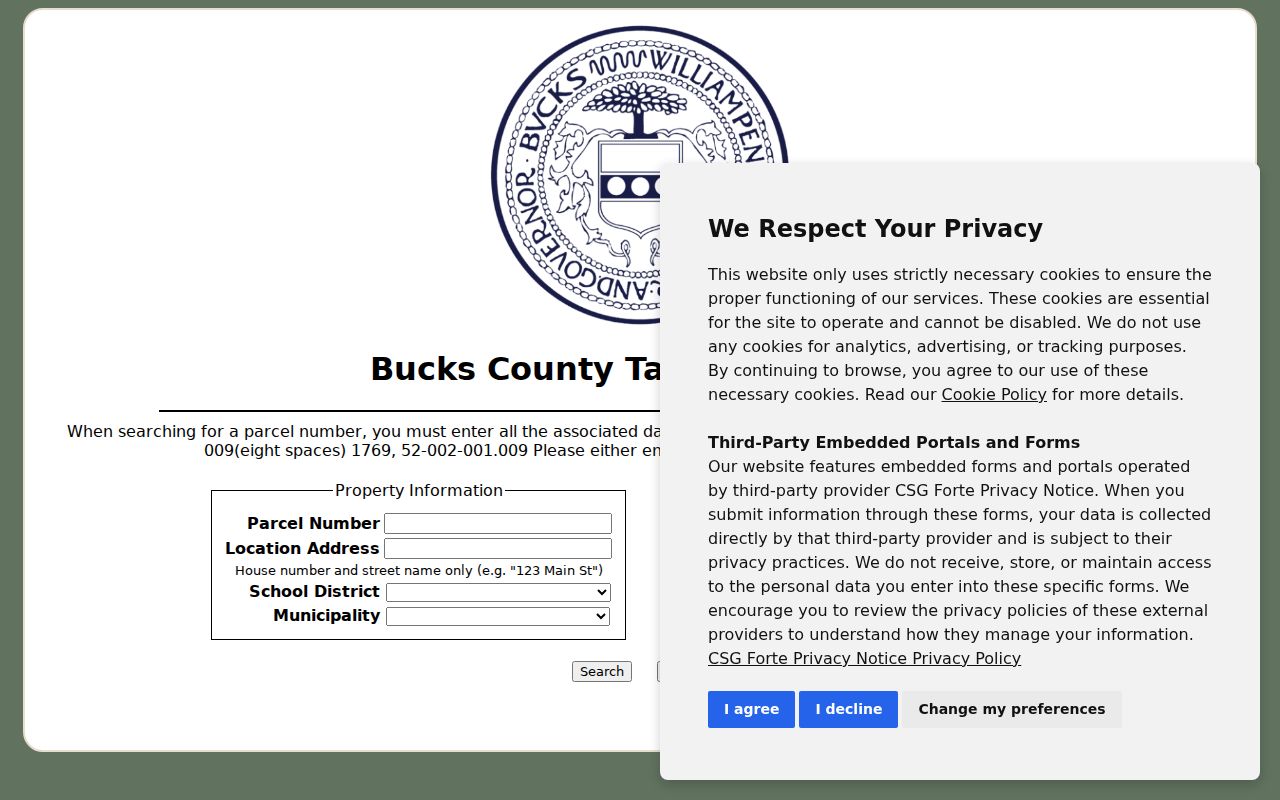
The visible ZIP control is useful for correspondence context, while an address or parcel number remains the stronger route to the actual property record.
Search Bucks County ZIP Code Records
No inspected Bucks County portal offers a ZIP-wide resident result. The assessment system is built around owner, physical address, and parcel searches. LANDEX is organized by party, date, document type, instrument number, or book and page. The Tax Claim inquiry has a ZIP control only for an owner's mailing information. Those different field sets make an exact address or parcel the reliable bridge from a delivery ZIP to a county record.
After USPS confirms delivery, run the physical address in assessment, save the parcel number and municipality, then use GIS for map context. A recorded-document question moves to the Recorder with a party and period. A local permit or inspection question goes to the municipality shown by the parcel, because no unified county permit or code-case search was found.
Separate Bucks County ZIP Code Boundaries
A location address is the parcel’s physical, or situs, address. Mailing Address, City, and ZIP are tax-correspondence fields. A recorded deed adds a legal description. These are different record concepts, and they can disagree without either being an error. Census ZIP Code Tabulation Areas are statistical approximations, not delivery routes. Use county parcel maps and the municipality directory whenever a postal city and municipal jurisdiction differ.
- ZIP and ZIP+4
- A ZIP identifies a delivery area. ZIP+4 adds a more specific delivery segment for a known standardized address.
- PO-box ZIP
- A ZIP used for post-office-box or special routing may not describe the physical location of a parcel.
- Unique ZIP
- A special-purpose postal code can route mail for a particular use and requires exact-address confirmation.
- Carrier route
- A postal delivery grouping, not a municipal boundary or resident list.
Postal limit. A Bucks County delivery ZIP is a routing clue, not evidence of municipal jurisdiction, property ownership, or who currently lives at an address.
Read Levittown in the ZIP Code Directory
Lower Bucks has a clear postal-community example. ZIPs 19054 through 19058 use the Levittown label, but Levittown is not one municipality. The research marks 19058 for exact USPS verification because special or PO-box routing may apply. A ZIP result should therefore lead to the parcel’s township or borough, not a claim that every Levittown mailing address is governed by one local records office.
Langhorne has a related issue: its postal community extends beyond the borough. Doylestown ZIPs 18901 and 18902 also cross municipal boundaries. In each case, the county’s assessment parcel and GIS viewer provide the local context that the postal label does not.
Fifty-Four Municipalities Behind a Postal Code
Bucks County had an estimated 647,828 residents over 604.37 square miles on July 1, 2025, and its 54 municipalities help explain why record labels vary. A result may use a borough, township, post office, school district, tax municipality, or ZIP. Historic tax rolls also use place names such as Bedminster, Bensalem, Bristol Borough or Township, Buckingham, and Doylestown Borough or Township.
Use the county municipality directory to route a local permit, inspection, or code question after the parcel is identified. The County Planning Commission provides the relevant municipal and GIS context. No unified county permit or code-case lookup was located, so the responsible municipality remains the proper custodian for its own address records.
Open the Bucks County municipal directory before using this municipal-routing image.
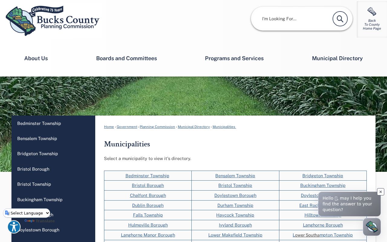
The municipal list supplies the local-office layer that a postal community name cannot supply on its own.
Keep Historic Bucks County ZIP Code Labels
Historic records need an older address strategy. ZIP Codes belong to the modern postal era, and postal zones change. For an old directory, census, deed, or tax-roll entry, preserve the original street, municipality, road or lot description, directory year, and census location rather than adding a modern ZIP as if it were part of the historic record.
The county did not identify one central retrospective street-name converter or countywide renumbering event. If old and current labels do not align, use the GIS-identified municipality and the Recorder’s legal-description chain. The Recorder is party and document oriented, while the assessment search is physical-address and parcel oriented. Those distinct access methods are more dependable than guessing from a present postal label.
Note: Older Bucks County sources may use township, borough, or post-office language that does not match the postal city now attached to an address.